
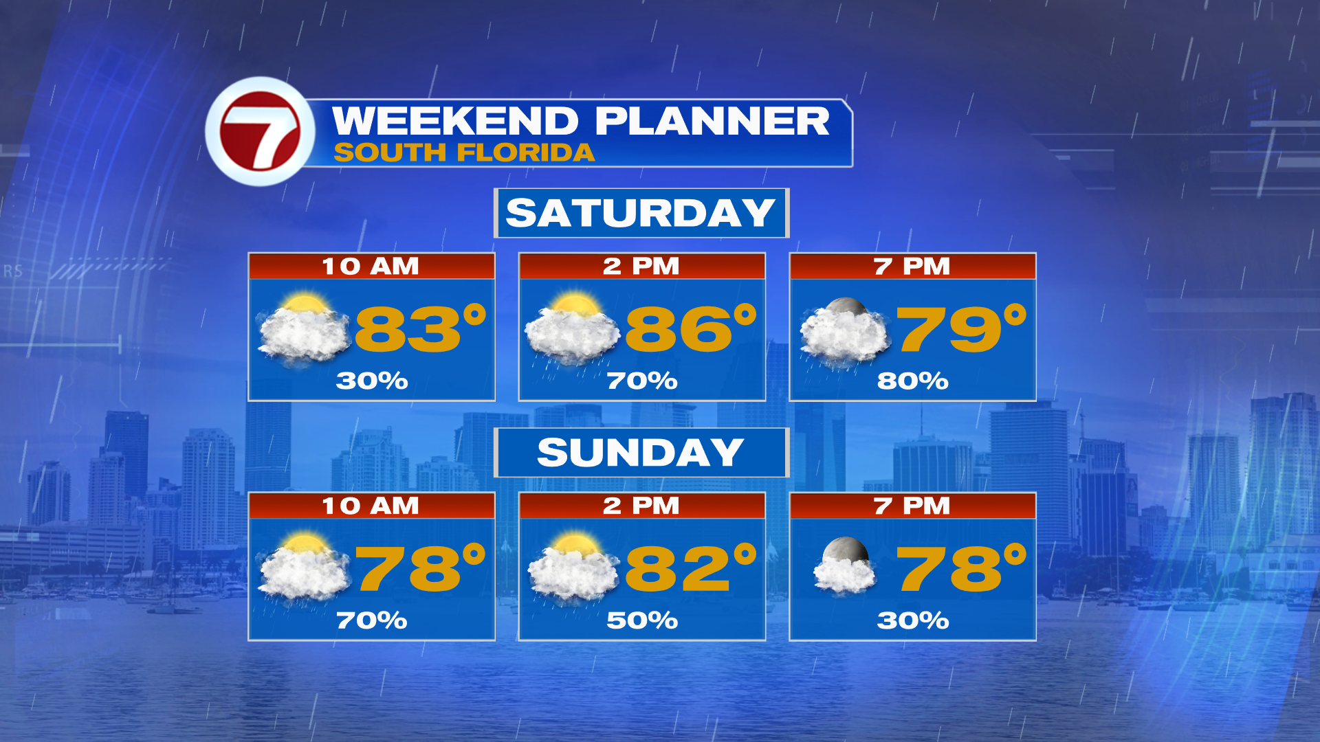
Happy Saturday, South Florida!
The big story this weekend is the first big Fall front of the season sweeping across South Florida!
Ahead of the front, we will see numerous showers and storms for Saturday. These storms will produce heavy downpours which could lead to flash flooding. You will definitely want to have a backup plan indoors. The front will push south and clear the area on Sunday morning. With it, Sunday morning looks quite wet, but highest rain chances will shift south into the Keys by Sunday afternoon.
Unfortunately, we wont be seeing any meaningful Fall weather here in South Florida behind the front. The sunshine and cooler temps will stay north of Lake Okeechobee. Behind the front we will turn very windy early to middle of next week. Wind gusts of 30 – 40 MPH off the Atlantic. Rain chances will be lower, however, daily coastal showers from the Atlantic will stick around through the end of the week. Otherwise, highs will be in the 80s with lows in the 70s.
TROPICAL UPDATE:
No tropical development is expected in the Atlantic for the next seven days.


